Wyrley and Essington Canal
Dubbed the Curley Wyrley, due to its constantly twisting course. the Wyrley and Essington canal was opened in the late 1790’s, for transportation of coal extracted from the many coal mines in the area. It ran from Wolverhampton to Huddlesford, with branches to Walsall, and Birmingham, passing through Brownhills, Pelsall, Aldridge, and Rushall. The reason behind the changing directions, was to keep the waterway level, so as to avoid building locks. However at Ogley Junction, the route to Huddlesford met with a downhill gradient of 50 feet, which needed a flight of eight locks to be constructed. Every barge that negotiated this lock system, used 25,000 gallons of water. A reservoir to top up the canal was built at Norton Canes, by diverting the Crane Brook and building a dam to contain the water, and a channel cut to feed the canal at Ogley Junction. As well as the Crane Brook water supply, the water which was pumped out of the local collieries also helped to fill the reservoir. In June 1799, the dam burst, and millions of gallons of water escaped,and flooded a large area as far as Shenstone. After rebuilding the dam, a lot thicker and stronger, the reservoir was reopened in 1800. The channel from Norton Pool, as the reservoir was called was widened in 1850 for coal traffic, from the mines in Norton Canes, and Cannock Chase. Canal narrow boats were loaded at Anglesey wharf, from coal wagons, brought by rail from the local collieries. Anglesey wharf closed to coal traffic in 1967. With the demise of the coal industry, Norton Pool, now renamed Chasewater, solely relies on Crane Brook, and natural rainfall to maintain its level.
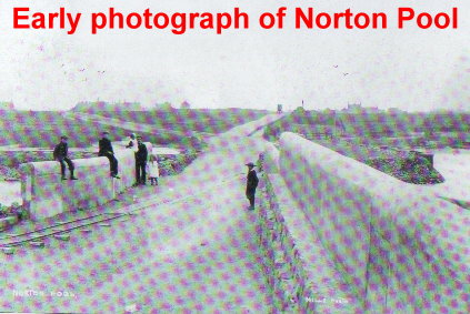
Early photos of Norton Pool dam. The following photo shows the overflow pool and the two associated buildings. The smaller of the two, in the centre of the picture controlled the sluice valve, which fed water from the pool into the canal. The larger building housed the pump, which was used to return water from the canal if the level rose too high.

Chasewater ( Norton Pool ) Today.

As you can see the water level is extremely low at present. To the right of the picture are 4 large pipes which go under the roadway into the overflow pool. The optimum water level is on a plane with these pipes.

The canal begins at the bottom of the dam, immediately below the sluice valve building. There is always a top up supply going into the canal, evident by a small weir.
A short distance along the canal is Anglesey wharf, where coal was transferred from railway wagons into canal narrow boats. Steel chutes were used to guide the coal into the moored boats.

Anglesey wharf showing the remains of the steel chutes, which were used to load the narrow boats with coal.
At this point the new M6 Toll road goes over the canal, adjacent to the old Wharf Lane bridge, which is no longer used as the motorway cut the minor road in two.
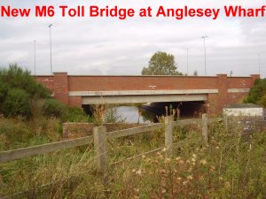

A fairly straight section of waterway brings to Freeth Bridge under the A5 trunk road.

The canal then passes over the old railway cutting in an aqueduct before going under Middleton Bridge on the Chase Road
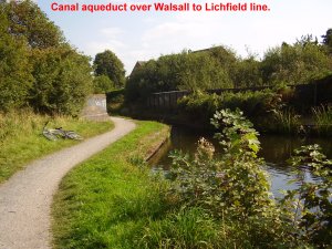

Turning slightly to the right the canal approaches Anglesey Bridge on the Lichfield Road known locally as the Chemical.

Immediately past this bridge lies Anglesey Junction and canal basin. At this point the canal turns sharp right towards Brownhills, with the basin on the left, under the towpath bridge.

Anglesey Junction, showing towpath bridge and entry into basin.

Anglesey canal basin from the bridge. The short section of water to the right is where the Huddlesford branch began its 50 foot descent, through the 8 locks towards Lichfield. This branch was closed in 1954 and subsequently the locks were all filled in. The basin is still used by private boat owners for mooring purposes, and working on their craft.

Photograph showing the mooring basin to the left, and boats being worked on out of the water.
After going under the A452 at the Anchor, the canal reaches Catshill Junction, where it divides into two directions.


Following the canal to the right, it runs parallel to Brownhills High St, past the market, and under the new bridge by Tesco’s.
An early photograph shows a canal boat leaving Catshill Junction and travelling in the direction of Pelsall. ( photo taken from Memories of Brownhills Past by Clarice Mayo and Geoff Harrington)

Another early photograph shows the now demolished Pier Inn which was situated at the end of Pier Street. ( Photo from Memories of Brownhills Past )

At this point today, stands the recently erected pedestrian bridge, which is a replacement for the old Pier street footbridge to Clayhanger.

The canal then turns sharp left by the canoe training centre. At this point a short waterway goes off to the right which used to feed the Railway Sidings at Brownhills Station.
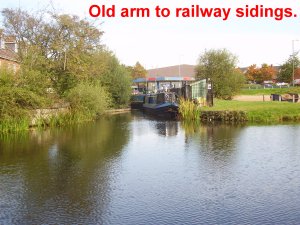
After going under the topless bridge remains, from the defunct Midland Railway, and Coopers bridge which went to Swing Bridge pig farm, the Curley Wyrley again takes a turn to the right.

After going under the Walsall to Lichfield Railway line, and the Pelsall Road, another left turn takes the waterway to the Jolly Collier bridge, on Coppice Side.
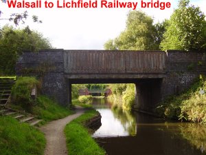

Another Railway line to go under at the Slough. This one is the Norton Junction to Norton Canes, and Cannock Chase Coalfields.

A few yards past the Slough bridge the canal makes a 90 degree turn to the left heading towards the Pelsall Road at High Bridges. At this turn there was a waterway off to the right connecting to Collieries in the Brownhills and Norton area.

After passing under the Pelsall Road at High Bridges, the Curley Wyrley lives up to its name, by making two more turns to the right, to once more go under the Pelsall Road, before turning left and passing beneath Lime Lane, adjacent to the Finger Post Public House ( was the Royal Oak ).

Yorks Foundry Bridge under the Pelsall Road.

Yorks Bridge under Lime Lane by Finger Post Public House.
A stones throw away from Lime Lane, another right hand junction serviced the Grove, and Jerome’s collieries at Norton Canes.

The waterway to the right, just past the towpath bridge, takes the canal through Pelsall Common, towards the Grove Colliery. The main canal makes its way to Reedswood junction where it divides into two. one section heads towards Walsall Town Centre, and the other towards Wolverhampton.
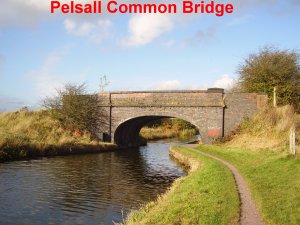

Site of the Railway Bridge from Grove Colliery to Norton Junction.
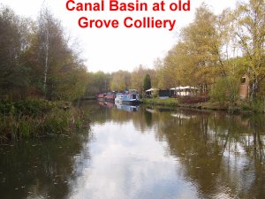
Canal Basin at the site of the old Grove Colliery. At this point coal was loaded into narrow boats for distribution Nation wide.

Recently constructed road bridge over canal by the entrance to the old Grove Colliery.
Today the canal ends at Yates boat yard, by the A5 Trunk Road, with the Norton extension filled in and re-developed.


Yates boat yard is the end of this section of canal. We will now return to Catshill Junction to follow the Rushall Branch as it wanders through Walsall Wood, Aldridge, and Rushall, before heading off towards Birmingham. The Rushall or Daw End branch was opened in 1802 to connect the Wyrley and Essington canal to the Lime pit workings at Hayhead.

At Catshill Junction the Rushall branch flows under the bridge heading towards Clayhanger Road Bridge where an adjacent overflow allows excess water to enter the Fordbrook.


Clayhanger bridge was replaced in 1994. A more gentle approach replaced the steep incline to the ancient wooden sided bridge.
A few yards past Clayhanger bridge there is a wider section. At this point there were two basins, feeding the Walsall Wood Colliery and the adjacent brickworks.
A local fisherman patiently waits for his dinner
Approximately half a mile brings us to the Black Cock Bridge
Named after the nearby public house its hard to believe that the pub and canal where once on the same level. Due to subsidence from coal mining and quarry work the hostelry is now considerably lower than the waterway. A steel footbridge has been erected to enable pedestrians to safely access the very steep and narrow roadway over the canal.
Running parallel to, but a lot higher than, the canal follows Hall Lane, and after passing St Johns Surgery goes under the A461 Walsall to Lichfield Rd at Walsall Wood Bridge.
The Fisherman monument stands on his pole at this point.
A small duckling tries out his surfboard
The next bridge to go under is Hollanders Bridge, which as been closed to vehicular traffic for many years.
At the rear of Barons Court, on Brickyard Road is Lathams Bridge
The canal then skirts the industrial area of Aldridge passing Aldridge Mariner before going under the 1883 Northywood Bridge
To the right of the canal there are other industries and sand quarries before the waterway passes by the overflow and goes under Aldridge Wharf Bridge.
Leaving Aldridge the canal then turns towards Rushall and heads off towards Birmingham.


January 31, 2018 at 8:25 pm |
Chap, the photo of the boat ‘leaving Catshill junction…’ doesnt show that, it shows Princess Anne passing under the footbridge on the stretch through Brownhills town. I know this cos its a photo from my collection, the boatman is my grandad. I dont mind you using it but saying where you got it from would be bostin.
February 15, 2018 at 2:26 pm |
Thank you for your comment on my blog article. I take your point that the boat as just passed under pier bridge, but as the blog is following the route of the canal and the previous paragraph was Catshill Junction, then it follows on that it as left the Junction. The photo was taken from the Memories of Brownhills Past by Clarice Mayo & Geoff Harrington. I have edited the blog to include this. Kind regards oakparkrunner.